Seamantix 1.3
Free Version
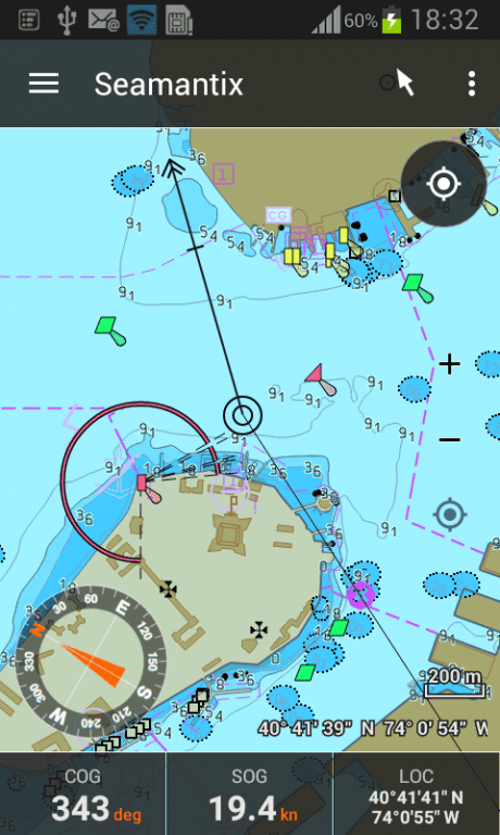
Publisher Description
Seamantix is a marine navigation app with pixel-perfect ENC nautical vector charts, IENC (Inland ECDIS) support, tracks, routes, and a sophisticated safety system which continuously monitors your vessel's safety at sea.
Seamantix comes without data; chart subscriptions are available in-app.
Full specs and more screenshots: http://www.satellite25.com/seamantix.html
Chart list: http://www.satellite25.com/charts.html
AVAILABLE DATA
- USA: NOAA (ENC)
- The Netherlands (IENC)
- Belgium (IENC)
- Germany (IENC)
FEATURES
MAP ENGINE
- ENC vector charts, rendered crisp, pixel-perfect on all scales
- visualization compliant with the IHO (S-52) and IENC specifications
- charts (depth areas, safety contours and underwater hazards) are colored according to your vessel's draft
- add tidal info: adjust chart depths and coloring to actual water level
- simplified and paper chart icon sets
- 3 color schemes (day/dusk/night) for optimal brightness
- filters: display categories, soundings, land areas, labels, metadata
- map operations: zoom in/out, panning, distance measurement
DATA
- easy chart installation via the built-in map manager
- all charts come with detailed attribute info of the map features, e.g.: buoy shape/type/name, light patterns, fog signal patterns, wreck depth, …
- background data: OpenStreetMaps (requires a network connection)
NAVIGATION AND ROUTES
- show current position in real-time using GPS
- compass: true and magnetic north
- center-map-on-vessel mode
- define routes (waypoints + legs)
- configure max cross-track-error and planned speed per leg
- speed vector (COG + SOG)
- bearing line from vessel to next waypoint
- heading line
- automatically advance to next waypoint when entering waypoint arrival circle
- navigation panel: configurable matrix of parameters (1x1 up to 10x10)
- supported navigation parameters: ALT, ASOG, BOD, BTW, CMG, COG, DMG, DOD, DPT, DTE, DTG, DTW, ETA, HDG, LAT, LOC, LON, MSOG, SOG, TIME, TIT, TMT, TOD, TTG, TTT, VMC, WLOC, WLON, WLAT, WPT, XTE
- monitor anchorage area
- routing notifications: via Android notification system and Android Wear
TRACKS
- continuous track recording
- log book: automatic recording of events (waypoint reached, distance progress, anchorage, alarms, …)
- plus manual logging of weather reports, fuel levels, engineering issues, …
SAFETY SYSTEM
- continuously monitoring of the vessel's safety
- Depth alarms: when approaching or entering shallow waters (distances and depths configurable)
- Route alarm: when deviating from route (distance configurable per leg)
- Anchorage alarm: when drifting away from the anchorage location (distance configurable)
- Man-Over-Board (MOB) mode
- Notifications: on map (visual), via Android’s notification system (visual+auditive), or via Android Wear
ENVIRONMENTAL INFO
- sunrise and sunset times
- available times: official, civilian, nautical and astronomical sunrise/sunset/twilight
SHARING/EXPORTING
- generate route and track reports as PDF, including waypoints, a map, route/track metadata, and the full log book with all events
- events can be filtered to generate specialised reports
- generate screenshots from the current route, track or map to share via e-mail, Facebook, Twitter, Google Drive,…
- import or export routes and tracks as GPX
UNITS
- Location: lon/Lat, UTM
- Length: metric, miles, nautical miles
- Speed: kilometers/hour, meters/second, minutes/kilometer, miles/hour, knots
- Time: 12h, 24h
- Temperature: celsius, fahrenheit, kelvin
- Volume: liter, US gallon, imperial gallon
ANDROID WEAR INTEGRATION
- notifications on Android Wear: navigation instructions, safety alarms
About Seamantix
Seamantix is a free app for Android published in the Geography list of apps, part of Education.
The company that develops Seamantix is Satellite25. The latest version released by its developer is 1.3.
To install Seamantix on your Android device, just click the green Continue To App button above to start the installation process. The app is listed on our website since 2015-09-27 and was downloaded 11 times. We have already checked if the download link is safe, however for your own protection we recommend that you scan the downloaded app with your antivirus. Your antivirus may detect the Seamantix as malware as malware if the download link to com.satellite25.geo.seamantix.android is broken.
How to install Seamantix on your Android device:
- Click on the Continue To App button on our website. This will redirect you to Google Play.
- Once the Seamantix is shown in the Google Play listing of your Android device, you can start its download and installation. Tap on the Install button located below the search bar and to the right of the app icon.
- A pop-up window with the permissions required by Seamantix will be shown. Click on Accept to continue the process.
- Seamantix will be downloaded onto your device, displaying a progress. Once the download completes, the installation will start and you'll get a notification after the installation is finished.
